Friday, January 30, 2009

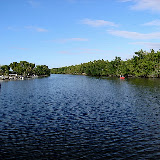
Looe Key

Today is Friday. For most of the day it was very hot and humid, with no breeze. Then a predicted cold front moved in, with a very heavy 30-minute downpour, followed by winds that reached up to 60 mph in less-protected areas than where we are moored. Now the temperatures have dropped about 20 degrees and we have the comforter back on the berth.

On Wednesday Lori and I took the boat out to Looe Key, a state park and protected marine area that is entirely underwater. It's located about 10 miles northeast of the bay where the KOA is located, out in the Atlantic on the edge of the reef that defines Hawk Channel, the main shipping channel along the east coast of Florida. On our way out of the bay I misread the channel markers and did not pay sufficient attention to the color of the water (it gets browner as it gets shallower) and ran aground. This time the boat was really stuck and we were not able to push it off. So we called Vessel Assist (think AAA for boats -- our membership paid for itself in full with what this one call would have cost) and within about 20 minutes a nice young fellow showed up in an open console cat with twin Suzukis -- basically the same configuration as our boat but without the pilothouse. In short order he got a line to one of our aft D rings and pulled us off the sandbar. He led us out the channel and since I turned on tracking on the chartplotter I was able to capture a record of how we got out. The more time I spend in the skinny water of Florida the more I learn, so it's been educational.

We had a tough slog out to Looe Key from the bay -- we had to run at displacement speeds and were only able to get up on plane returning to the bay. Once we got out there we had a difficult time finding  a mooring ball to tie on to that had  any kind of interesting features beneath the water. We returned somewhat disillusioned.

Earlier in the week we had met a couple working at the KOA, Bob and Barbara Tanner. They had previously owned a KOA in Jerome, ID before selling and going on the road full-time. We had invited them to go boating with us later in the week when they were not working (there are a large number of retired people who work part-time for the campground as "Work Kampers".) 

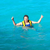
When we saw the Tanners again and told them of our disappointing trip but decided to give it a another try yesterday (Thursday). What a difference! The waves were much smaller and we were able to get up on plane leaving the bay until we got to Looe Key. Barbara and Lori snorkled while Bob and I talked and kept an eye on the girls. They reported seeing a wide variety of beautiful fish, vegetation, but not much live coral (the reef has been heavily damaged by anchors and other problems -- the state is trying to protect what is left as much as is possible.) Here is a link to a Picasa album with some photos from Looe Key:
Looe Key

After returning to the marina and cleaning up, Bob and Barbara took us to the No Name Pub, a pizza and beer joint that is, "A nice place . . . if you can find it." The walls are covered with dollar bills on which customers have written messages or drawn artwork. Very good pizza! Here's a link to the pub's website: .

We're planning to stay here through the weekend, and hopefully by Monday the worst of the cold front will have passed by and we can head north toward Ft. Lauderdale.

Kingston Earthquake

Just heard from the Brats that at 5:30 AM there was a 4.6 magnitude earthquake with its epicenter 2 miles from Kingston, WA. Most of you know that is where Bill and Judy Ford live but they are not there -- they are currently skiing in Canada. Sure hope their house and boats are OK.

Monday, January 26, 2009

Key West, FL

We spent the afternoon sightseeing in Key West. Toured the USCG Cutter Mohawk, which is under restoration after being rescued from the scrapyard in Staten Island. Here we are on the fantail of the ship:


The pelicans here roost in trees -- first time I have seen this. Here's a photo:


Saturday, January 24, 2009

Fishing Derby

This morning we fished in a derby to raise money for kids with cancer. The KOA is located next to two bridges, one an old auto bridge now used for pedestrians and fishing. The derby was only from 9 to 11 AM; entry fee was $5 so as you can see it was a low-key affair. Lori caught 3 mangrove snappers on live shrimp, all about 7-8' long. The winning fish was 11". Lori is still up on the bridge fishing, so maybe she will come back with more fish.

Yesterday we drove north to check out Bahia Honda State Park (they have a marina where we will probably stop for a night or two) and the city of Marathon (not impressive from the road, may be better from the water.)

The cold front has finally departed and it is warmer -- in the 70s and climbing. But there is a steady 9-10 mph breeze.

Wednesday, January 21, 2009

Sugarloaf Key, FL

Well, here we are, in the fabled Florida Keys! Feels more like home right now -- temp 54, with wind chill 47! There is a cold front moving down Florida that is supposed to take the temps in Naples down to 20. It is supposed to warm up to 70 and be sunny by Friday. We arrived here on Monday and spent Tuesday watching the inauguration (yeah!) and doing laundry. 

As you know from my SPOT (googlemap) posts here, we were in a campground and marina at Everglades National Park for several days. We completed setting the boat up for launch, launched, and spent two nights in the Flamingo marina before heading out into Florida Bay.

The facilities at Flamingo are heavily hurricane-damaged. The lodge and cottages are totally uninhabitable. The marina store does not sell fuel although the tanks and pumps are all there (they are changing concessionaires.) The toilets in the campgrounds have fallen into such a state of disrepair that they really need to be seen to be believed. All in all, for what should be one of the premier national parks, the facilities at Everglades are a sad commentary on how far and how fast the National Park Service has fallen in the past eight years. We can only hope that some of the Obama public-works funds will be allocated to repairs in our national parks.

Here is a link to an album of photos from Flamingo:
To get to Sugarloaf Key we had to transit Florida Bay to Seven-Mile Bridge (approximately in the middle of the Keys), go under the bridge into the Atlantic Ocean and then go southwest to Sugarloaf (14 miles from Key West.) We had several adventures en route.

Boating in Florida is nothing like boating in the Pacific North West. The water is very shallow,
 and it is easy to run aground, as we found out (all the guidebooks say this is SOP, but still it is disconcerting.) The reason we ran aground had multiple causation, but in the end it was my fault. First, many of the channel markers were damaged in the hurricanes that have hit south Florida in recent years. The channel marker numbers often do not agree with what is on the charts, but I found out later that one should just trust the markers (verifying visually and with depthsounder, of course) and follow them.

Complicating the navigation are the many crab pots, which would not be so bad if they did not have long lines attaching them to their floats. In water 2.5' deep, a 10' crab pot line creates a 7.5' horizontal obstacle that needs to be avoided -- but one first has to determine which direction from the float the line is drifting. Long story short, I failed in trying to avoid one of these crab pot lines, got my prop fouled and then went aground. Lori stripped down, jumped in the water (chilly but bearable, she said) and cut the crab pot line free, then pulled the boat off the shoal. What a gal!

After our adventures on Florida Bay we thought we were home free. Nope! We encountered a little thing called the Gulf Stream and 15 knot winds as we slogged our way against both from
 Seven Mile Bridge to Sugarloaf Key. Because of the wind, we could not get up on plane without getting badly beaten up so were limited to a very fuel-inefficient 10 knot speed. And because we were bucking the 8-knot Gulf Stream, we effectively only made about two knots over the ground.

As a result it took us all afternoon to get from the bridge to the channel leading back to the KOA where we are staying. Here, as elsewhere, the channel markers were out of sequence and did not agree with the charts, but we made it to the bridge where we had been told the KOA was on the other side. Only one problem: the bridge has only about 6' clearance. Fortunately, however, our information was incorrect and the KOA marina was located on our side of the bridge.

The people here are incredibly nice, the facilities are wonderful and aside from the distinctly un-Floridan weather, we are very happy to be here. We plan to use this as a base for at least the next week. We are renting a car and will use it to explore Key West and check out where we might stay or anchor on our way back. We have not yet decided whether we will go north along the east coast of Florida past Ft. Lauderdale and Miami to Stuart, and from there transit through the Okeechobee to the Ft.. Myers area on the west side of the state.


Monday, January 19, 2009

OK ESN:0-7399410

Warren & Lori are here:
ESN:0-7399410
Latitude:24.6606
Longitude:-81.5185
Nearest Location:not known
Distance:not known
Time:01/20/2009 00:13:13 (GMT)
http://maps.google.com/maps?f=q&hl=en&geocode=&q=24.6606,-81.5185&ie=UTF8&z=12&om=1

OK ESN:0-7399410

Warren & Lori are here:
ESN:0-7399410
Latitude:24.6338
Longitude:-81.3119
Nearest Location:not known
Distance:not known
Time:01/19/2009 20:37:58 (GMT)
http://maps.google.com/maps?f=q&hl=en&geocode=&q=24.6338,-81.3119&ie=UTF8&z=12&om=1

Saturday, January 17, 2009

OK ESN:0-7399410

Warren & Lori are here:
ESN:0-7399410
Latitude:25.1359
Longitude:-80.9469
Nearest Location:not known
Distance:not known
Time:01/17/2009 23:48:21 (GMT)
http://maps.google.com/maps?f=q&hl=en&geocode=&q=25.1359,-80.9469&ie=UTF8&z=12&om=1

Friday, January 16, 2009

OK ESN:0-7399410

Warren & Lori are here:
ESN:0-7399410
Latitude:25.4217
Longitude:-80.777
Nearest Location:not known
Distance:not known
Time:01/16/2009 19:37:25 (GMT)
http://maps.google.com/maps?f=q&hl=en&geocode=&q=25.4217,-80.777&ie=UTF8&z=12&om=1

Thursday, January 15, 2009

OK ESN:0-7399410

Warren & Lori are here:
ESN:0-7399410
Latitude:26.0494
Longitude:-81.7082
Nearest Location:not known
Distance:not known
Time:01/15/2009 22:22:25 (GMT)
http://maps.google.com/maps?f=q&hl=en&geocode=&q=26.0494,-81.7082&ie=UTF8&z=12&om=1

Wednesday, January 14, 2009

St. Petersburg, FL

Tonight we are in St. Petersburg, having driven as swiftly south along the coast as we could, to avoid the 25 low predicted for Tallahassee tonight and the 16 or 17 low predicted for the next two nights. Tallahassee is inland and north of Apalachicola, so we are hoping our proximity to the coast and our more-southerly location will keep us out of the freeze.

OK ESN:0-7399410

Warren & Lori are here:
ESN:0-7399410
Latitude:27.8209
Longitude:-82.7713
Nearest Location: , Bay Pines, FL, US
Distance: 0 km(s)
Time:01/14/2009 23:10:43 (GMT)
http://maps.google.com/maps?f=q&hl=en&geocode=&q=27.8209,-82.7713&ie=UTF8&z=12&om=1

Tuesday, January 13, 2009

Apalachicola, FL

We came to Florida to find the warm. Since it's 43 outside this evening, obviously we haven't found it yet! 

Since my last post, we spent two very enjoyable days with Bob and Marie Austin at Camp Thataway, their bayou-front house in Pensacola. We arrived on Saturday afternoon and parked the rig on the empty lot next to their house. That evening, fellow C-Brat Roger Rockwell and his wife MaryJo joined us for dinner, bringing along scrumptious crab and shrimp. Dinnertable discussion gave us ideas for several excellent cruising destinations in the area, when we return north -- after it warms up!

On Sunday, Bob gave us the full geographical, socio-economic, political, maritime and military tour of Pensacola. We identified the best place to launch the boat when we return, and some places to visit while cruising in the area. Then we toured the Naval Aviation Museum, located on the grounds of NAS Pensacola. Here we are at the museum:


We are now finishing up two days in Apalachicola on Florida's "Forgotten Coast" while the boat was being serviced by C-Dory dealer Wefings Marine. Nothing was wrong with the boat but we wanted to get it checked out and have regular maintenance performed before we launched. By happenstance we ended up staying at the Coombs House Inn bed and breakfast here -- a most luxurious experience!

Tomorrow we continue our journey south.

Monday, January 12, 2009

OK ESN:0-7399410

Warren & Lori are here:
ESN:0-7399410
Latitude:29.7263
Longitude:-84.9859
Nearest Location: Avenue E, Apalachicola, FL, US
Distance: 0 km(s)
Time:01/13/2009 00:26:24 (GMT)
http://maps.google.com/maps?f=q&hl=en&geocode=&q=29.7263,-84.9859&ie=UTF8&z=12&om=1

OK ESN:0-7399410

Warren & Lori are here:
ESN:0-7399410
Latitude:30.1978
Longitude:-85.8135
Nearest Location: , Panama City Beach, FL, US
Distance: 0 km(s)
Time:01/12/2009 19:58:38 (GMT)
http://maps.google.com/maps?f=q&hl=en&geocode=&q=30.1978,-85.8135&ie=UTF8&z=12&om=1

Saturday, January 10, 2009

OK ESN:0-7399410

Warren & Lori are here:
ESN:0-7399410
Latitude:30.4961
Longitude:-87.3062
Nearest Location: Pine Forest Rd, , FL, US
Distance: 0 km(s)
Time:01/10/2009 23:10:37 (GMT)
http://maps.google.com/maps?f=q&hl=en&geocode=&q=30.4961,-87.3062&ie=UTF8&z=12&om=1

OK ESN:0-7399410

Warren & Lori are here:
ESN:0-7399410
Latitude:30.4826
Longitude:-88.3807
Nearest Location: Christian Acres Ct, , AL, US
Distance: 0 km(s)
Time:01/10/2009 21:30:13 (GMT)
http://maps.google.com/maps?f=q&hl=en&geocode=&q=30.4826,-88.3807&ie=UTF8&z=12&om=1

OK ESN:0-7399410

Warren & Lori are here:
ESN:0-7399410
Latitude:30.3507
Longitude:-89.4473
Nearest Location: I- 10, , MS, US
Distance: 0 km(s)
Time:01/10/2009 20:03:38 (GMT)
http://maps.google.com/maps?f=q&hl=en&geocode=&q=30.3507,-89.4473&ie=UTF8&z=12&om=1

Friday, January 9, 2009

Still in Lafayette

We decided to forgo New Orleans and spend the day working on the boat. It was time well-spent, as we now have everything squared away in the cabin. In the cockpit, that'll have to wait until we get closer to the water.

Louisiana, at least this part of it, is very foreign to me. The way they construct their road systems seems to be deliberately designed to increase the chances of a high-speed collision. It got warm today, but the constant breeze made it not warm, and actually cool at times. The sun setting in the trees conveys the essence of what I expected from the Gulf Coast, even though we are a ways inland.

And the food. We had dinner tonight at Prejean's, a well-recommended Cajun establishment about 9 miles away. I had a cup of their 3-time gold-medal winning sausage and chicken gumbo and a crab and crawfish-stuffed Cajun-seasoned fillet of Red Snapper. Both were beyond delicious, but the accompaniments were intriguing as well. I'm not sure what they were, exactly. One was a ball of rice which the server said was cooked with ground meat. The other was a cooked pastry shell, such as you would use for a dessert tart, filled with something that was like corn but different. And over the snapper, they served a ladleful of crawfish etouffle that was to die for.

We leave for Florida tomorrow.

Thursday, January 8, 2009

Lafayette, LA

We're finally done with all 880 miles of I-10 in Texas, and are settled in at a KOA campground here -- that is, after Lori used the vice grips to get my hands off the steering wheel. The Houston-Louisiana stretch of I-10 was, as they say, "challenging"! If you remember the I-15 reconstruction for the 2002 Salt Lake Olympics, that will give you an idea of what these Texas roads were like.

Wednesday, January 7, 2009

San Antonio, TX


Today we drove into San Antonio to do some sightseeing. Wow, the highways in this town are a maze of narrow, twisting lanes, frequently under construction. But thanks to the miracle that is a GPS system we made it to the downtown square where the Alamo is located. Here is Lori at that iconic Texas location. Just like being in a church: men have to remove their hats and no one can take photos. On reflection, that's not a bad comparison: the Alamo is the cathedral of Texas culture.

After returning to the KOA campground where we are staying, we spent another couple hours stowing stuff away in the boat. It is impressive how much you can pack away in a boat if you really try!

Tomorrow we are headed to Louisiana!

Tuesday, January 6, 2009

OK ESN:0-7399410

Warren & Lori are here:
ESN:0-7399410
Latitude:29.4351
Longitude:-98.4231
Nearest Location: Gembler Rd, San Antonio, TX, US
Distance: 0 km(s)
Time:01/06/2009 21:32:00 (GMT)
http://maps.google.com/maps?f=q&hl=en&geocode=&q=29.4351,-98.4231&ie=UTF8&z=12&om=1

Monday, January 5, 2009

Sonora, TX

One of the challenges of driving in Texas is that you can't always drive the exact distance you want every day, because towns along I-10 are fairly widely spaced. This means that sometimes you have to stop earlier than you'd like because the next town is too far down the road for the current day's drive. But sometimes things work out the way you want, and yesterday we made 400 miles to Van Horn. We heard on the news that freezing rain was expected the next morning, so we delayed our departure until about 10 a.m., and I am glad we did because there were numerous indications that early-morning driving was quite treacherous. Our truck was covered in ice when we went out to get it loaded.

Fortunately, by the time we left, the ice was off the road, although the rain continued to fall and form ice on the windshield. We had to stop once to scrape off the windshield and wiper blades, but eventually we left the rain behind and enjoyed 45 degree temps the rest of the drive to Sonora. We decided to stop here early, after driving 261 miles, and from 4 to 6 we completed the job of offloading gear from the truck into the boat. Not everything is stowed away, but most of the important gear is now on board.

Tomorrow we are going to try to do some sight-seeing in San Antonio.


OK ESN:0-7399410

Warren & Lori are here:
ESN:0-7399410
Latitude:30.5772
Longitude:-100.6491
Nearest Location:not known
Distance:not known
Time:01/05/2009 21:44:56 (GMT)
http://maps.google.com/maps?f=q&hl=en&geocode=&q=30.5772,-100.6491&ie=UTF8&z=12&om=1

Saturday, January 3, 2009

Benson, AZ

We got up early (well, earlier!) and made 357 miles today, through Phoenix and Tucson to Benson (40 miles east of Tucson.) Here's a photo of the rig at a "rest stop" (no bathroom facilities) between Phoenix and Tucson


For all you Ike fans out there, here he is on his back-seat "throne." 


We've come 1892 miles thus far, with 1732 miles to go. Tomorrow: Texas!


Friday, January 2, 2009

Kingman, AZ

We wanted to get further than Kingman today, but could not find a place to stay that was not further than we wanted to drive. So we stopped and spent the rest of the afternoon making a start on getting the boat ship-shape. We have a lot of stuff to stow but the good news is that we've moved about a third of the stuff from the truck to the boat. I can actually see out the back now!


Thursday, January 1, 2009

Mesquite, NV

This morning we made our way to Brent & Dixie's place in Richfield to pick up the Lori Ann, where it had been stored since October in one of Brent's many garages and outbuildings. (Their new place in Loa is to die for -- something like 1500 square feet of living space and 4500 square feet of garage!)

With the radar scanner mounted, the boat is 13'4" high -- 4" higher than the 13' garage door. To get it in the garage, we had to dismount the scanner and lay it on the cabin top. Thus configured, the boat was approximately 12'9" high -- plenty of room if the garage door did not sag, which it did. But thanks to a strategically-place piece of conduit wedged between  the door frame and the door, we were able to achieve the full 13'.

Our only difficulties arose because the new GMC truck is significantly lower than my now-retired Dodge Cummins hauler. The truck, on the gravel driveway, was an inch or so lower than the boat, on the concrete pad of the garage. When we lowered the coupler onto the hitch ball, we were unable to retract the trailer jack to its traveling position. However, by blocking the trailer up with scrap pieces of wood and metal, we were able to retract the jack. We then drove the trailer off the blocks. Not an elegant solution, but it worked! The only casualty of this procedure: a formerly-square piece of metal that now looks more like free-form sculpture, which we left as a thank-you gift for Brent and Dixie. I'm still scratching my head trying to understand why we could not get the trailer out of the garage the same way we put it in.

After re-mounting the radar scanner without incident, we headed west on I-70 about noon. Sure feels different to have 10,000 lbs. hanging off the rear again! But the rig drove well and we spent the afternoon making our way to Mesquite. We're at the Virgin River Casino, a singularly unremarkable lodging and dining establishment.

Tomorrow we need to find a 30 amp locking-to-RV converter so we can run the boat's electric systems from RV park hookups. The Home Despot in Richfield did not have it; we're hoping to find an RV store that will.

Happy New Year to All!